
In late December it was laid out why a substantial pattern change was expected to start January, with increased cold and at least some increase in snow across the U.S. and Canada. However, it was a bit uncertain exactly how quickly the pattern would change, how quickly the cold air supply would be able to recharge in Canada, and how quickly the trough axis would settle into the western U.S. Answers are becoming clearer with several systems to track for snow potential through the middle of January along with a blast of legitimately Arctic air into the Lower 48.
This post will at least briefly touch on:
- A check in on how the pattern has evolved recently, allowing for winter to finally start on a consistent basis in the Continental U.S. (CONUS) and Canada
- Several systems to watch for snow potential across the (CONUS) over the next two weeks
- A blast of legitimate Arctic air into the west later this upcoming week (week of January 8th)
- A look at what the various large-scale forcing mechanisms/teleconnections may suggest for the second half of January into February
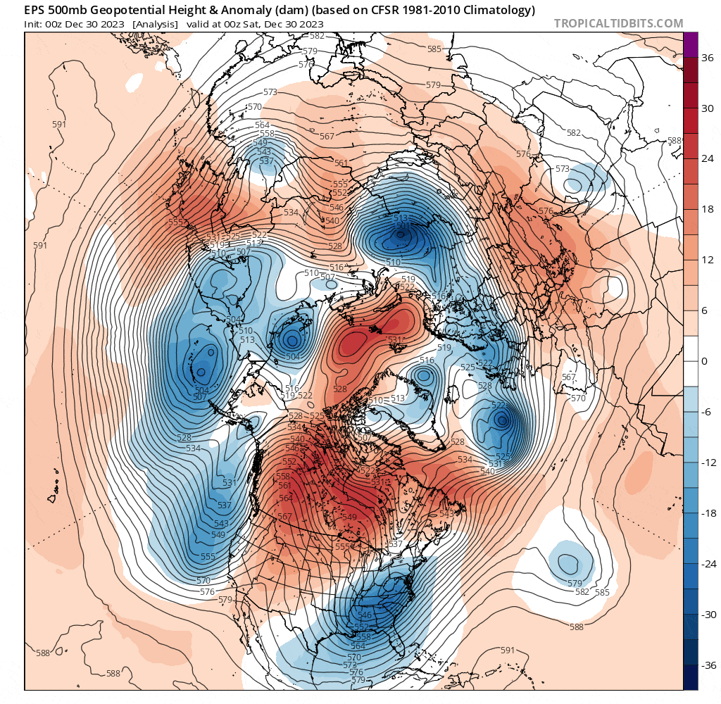
At the start of the loop in the final days of December we still hadn’t shaken the Pacific-dominated pattern. However, the Pacific jet quickly retracted and allowed ridging to build along the West Coast and into Alaska, with a series of wave breaks over the northern Pacific building a block that will retrograde through mid-January. The retraction of the Pacific jet and West Coast ridge cut off the Pacific influence into the CONUS and Canada, and the block will facilitate cross-polar flow into Canada. That is how you quickly re-charge the cold air supply into North America. The downside for snow lovers across the parts of the southern/eastern U.S. is that the bulk of the cold air initially dumps into the west. This happens because the Pacific pattern is quickly retrograding towards a -PNA.
Over the next week a series of wave breaks over eastern North America and the northwestern Atlantic will build an impressive North Atlantic block/-NAO, with the ensembles agreeing the block will retrograde through mid-January. Check out the series of wave breaks over the North Atlantic over the next 10 days, and how each one seems to contribute to building the block/ridge:
Nearly all -NAO blocks (and north Pacific/-EPO blocks for that matter) are a result of a well-timed wave break occurring, with the blocks lasting longer and having a greater impact on the pattern when the larger-scale forcings are favorable. With an ongoing stratospheric warming event/weak stratospheric polar vortex coupling to the troposphere, recent MJO propagation across the Western Hemisphere, and ongoing negative Rocky Mountain Torque event the large scale forcings all favor blocking across the North Atlantic.
Tropical forcing passed through the western hemisphere and into Africa (phase 1-2 MJO) at the end of December/beginning of January:
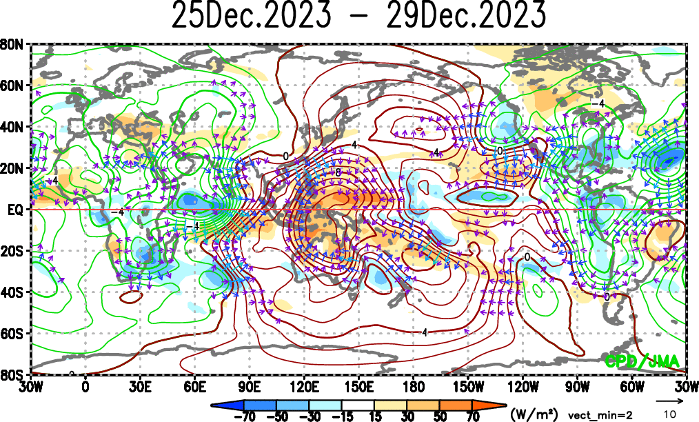
This acted to raise heights over the tropical Atlantic, tightening the gradient and speeding up the jet stream across the sub-tropical Atlantic. This is a typical response to MJO phases 1-2:

This increased storminess across the North Atlantic, which is helping to build the -NAO. At the same time, a prolonged negative Rocky Mountain Torque (RMT) event is just getting underway and will continue through mid January. Remember how a positive East Asian Mountain torque can speed up and extend the north Pacific jet? A similar effect can happen across the north Atlantic due to Rocky Mountain Torque, with a negative RMT suggesting a retracting Atlantic jet, favoring the development/persistence of blocking.
Note how early in the loop there was high pressure east of the Rockies, a +RMT. That has already switched to low pressure/a -RMT, which will continue for another week or so. Note the retrograding ridging across the North Atlantic made possible by a weakening of the jet due to the change in tropical forcing and negative RMT. Also note the persistent -EAMT and retracting/retrograding pattern across the North Pacific until close to the end of the loop, supporting the -PNA/western North American trough.

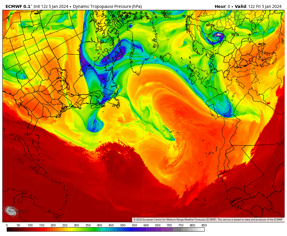
The recent/ongoing north Pacific jet retraction and upcoming north Atlantic jet retraction can be seen on the above 250mb wind loop, focusing on the core of the jets. The recent extension of both jets, followed by a retraction and need to disperse this momentum through a series of strong mid-latitude cyclones/wave breaks, was directly caused by recent tropical forcing and mountain torque activity and is a large reason for the upcoming high-latitude blocking across both the Pacific and Atlantic.

The stratosphere has seemingly been influencing tropospheric blocking recently and that should continue given the receptive El Nino/easterly QBO base-state. An ongoing weakening of the stratospheric polar vortex is expected to downwell and help encourage high-latitude blocking in the troposphere for the foreseeable future.
Summing up where we’re at so far: Strong and persistent high-latitude blocking is consistently shown on the ensembles and heavily supported by nearly all large-scale forcing mechanisms. The recent pattern change supports much more polar and arctic influence into Canada and the CONUS. The blocking suggests the arctic air will be dislodged south. The large-scale forcings also support a -PNA and western trough so the bulk of the cold will initially drop into the west. The subtropical jet will remain active.
What does this mean for storm chances and where will it snow?
I know, I know, I buried the lead here. My bad. Storm #1 is this weekend:

The start of the loop appears to have so much potential for a big, amplified storm. Unfortunately, the trough is not ejecting in one piece. A potent trailing shortwave along with some confluence ahead of the lead shortwave shears it out. The trailing shortwave leads to a prolonged event, especially for southern New England where there may be a bit more interaction between the polar jet energy and the trailing shortwave. In addition to the storm being relatively strung out it’s simply not that cold:
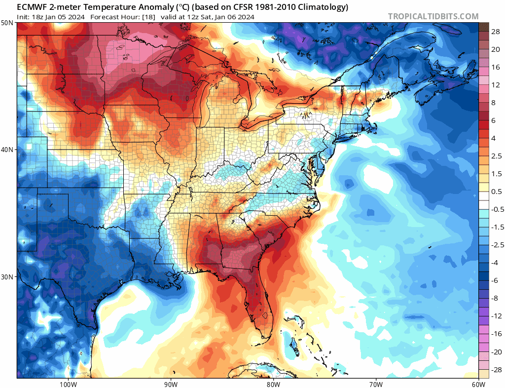
Heck of a way to run a winter storm, with temperatures at or above average except for where steady precipitation is ongoing during the daylight hours. Since it’s January, the coldest time of the year climatologically, this is still cold enough for snow (and ice farther south) from the mountains in the Southeast into the interior Mid Atlantic and much of the Northeast. There will be a swath of warning-level snow/ice impacts with this storm, though it won’t be a NESIS storm with limited impact to the big I-95 corridor cities from NYC south. The biggest concern will be power outages from ice in the southern Appalachians and heavy wet snow farther north.
The next significant system will be a large Great Lakes cutter January 8-10:

This has been telegraphed as a large/strong Great Lakes cutter for quite a while. This will be a dynamic system and will be relatively high-impact. A huge trough ejects in one piece out of the western U.S. with plenty of spacing between it, the departing Northeast weekend storm in front of it, and the next shortwave behind it. Cross-polar flow is building cold air over Canada and some of this will be tapped by the storm as it deepens next week. At this point, the questions are if the blocking ahead of the storm or interaction with the next incoming shortwave behind the storm can lead to a flatter solution and nudge the track slightly farther southeast. To me this seems like it is locked in as a relatively large and strong low…it’s just a question of exactly how strong it gets and exactly where it tracks.
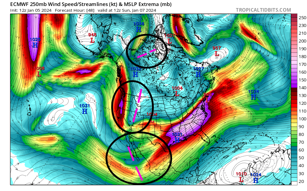
There will be three distinct pieces of jet energy interacting between the sub-tropical jet, polar jet, and arctic jet (from south to north)…and the airmass getting drawn up ahead of the developing storm will be juiced, with a large area of precipitable water values well above normal for this time of year:

The impressive plume of deep moisture indicates a warm, humid, unstable airmass for this time of year. This encourages more precipitation and latent heat release, allowing for stronger positive feedback as the low deepens and ultimately a quicker, stronger intensification. A strong low-level jet develops in the warm conveyorbelt over the eastern CONUS, peaking in intensity along the eastern seaboard. This will support impactful severe weather along the Gulf Coast and Southeast Coast Monday and Tuesday. Heavy precipitation (largely rain) will fall in the warm conveyorbelt ahead of the low along with strong south-southeast winds, especially near the coast. This will be a very impactful event with the rain occurring on top of recent snowfall, already saturated soils and on rivers that have recently experienced flooding from the northern Mid Atlantic into the Northeast/New England. On the cold side, the rapid deepening and strong dynamics should support a swath of accumulating heavy, wet snow. The above normal PWAT values wrapping all the way around into the cold conveyorbelt suggest a heavier, wetter snow with plenty of moisture. There will also be gusty winds behind the low pressure.

As mentioned, the ensembles are and have been consistent on a strong Great Lakes cutter solution. There is still some spread in location Tuesday night, from as far west as Lake Michigan to as far east as the Finger Lakes, though nearly all members have a minimum pressure in the 970-980mb range. An impactful storm is coming, with severe weather along the Gulf Coast and near the coast in the Southeast, flooding and gusty wind concerns along the East Coast, a swath of heavy, wet snow on the northwest side of the low track from parts of the Plains and Midwest into the Great Lakes, and a broad swath of gusty winds behind the low pressure as well. While this will mainly be a warm and rainy storm for the East Coast some impactful ice/snow is possible, mainly in the mountains of the Mid Atlantic into Upstate NY and central/northern New England.

Given the impressive ingredients and consistent signal, the WPC already has an unprecedented Day 5 Moderate Risk for excessive rainfall and flash flooding (likely a combination of flash flooding and river flooding) across parts of NJ and southern NY, with a large Slight Risk surrounding it.
As this large low pressure tracks through the Great Lakes and into southeastern Canada around midweek a lobe of the tropospheric polar vortex will begin to drop into western and central Canada. Prolonged cross-polar flow will bring quite a bit of Siberian air into the North American side of the North Pole:
Starting early in the loop, note the flow directly across the pole into north central Canada. This continues through the loop as ridging continues to amplify from the Pacific, across Alaska and towards the pole. Eventually, a lobe of the tropospheric polar vortex begins settling into southwestern Canada and towards the Pacific Northwest and northern Rockies.
As the lobe of the TPV drops into Canada strong surface high pressure will build over much of Alaska and northern/western Canada this upcoming week. This will give the Siberian airmass time to radiationally cool over snow pack that’s relatively fresh over southwestern Canada:

The ingredients are in place for a legitimately bitter Arctic airmass to drop into western and central Canada next week and continue to mature before dropping into the Pacific Northwest, Rockies, and Plains to end the week and into next weekend. The bulk of this cold initially goes into the western and central U.S due to the -PNA, with a stormy pattern continuing ahead of the cold air.
The next timeframe to monitor for a storm with snow potential comes January 12-13 over the central and eastern CONUS (Jan 10-11 over the Southwest):

The next large shortwave in this pattern is expected to eject into the Plains around January 12th, with support from all 3 ensembles (EPS, GEFS, GEPS). This one will be a cutter as well though with a retrograding -NAO block, polar vortex lobe, legitimate arctic air pressing into western and central Canada, and some semblance of troughing extending towards southeast Canada there is a fair amount of uncertainty regarding how much it cuts…many ensemble members eventually have re-development closer to the New England coast. It will also be much colder behind this storm given the legitimate arctic airmass dropping into the western U.S. and Plains.
If there’s sufficient separation between the storm, the polar vortex lobe, and the trough over southeast Canada this low pressure could get well into the Great Lakes before running into the blocking and re-developing near the New England coast. However, if any of those above 3 features interfere with the storm more it would be less amplified, tracking farther southeast (perhaps just towards the upper Ohio Valley before re-developing off the Mid Atlantic or southern New England coast). There will be some more cold air ahead of this storm so there may be more front end snow (and ice east of the Appalachians) to go along with a swath of back-end snow, with a much more conducive airmass for higher-ratio snow on the backside.
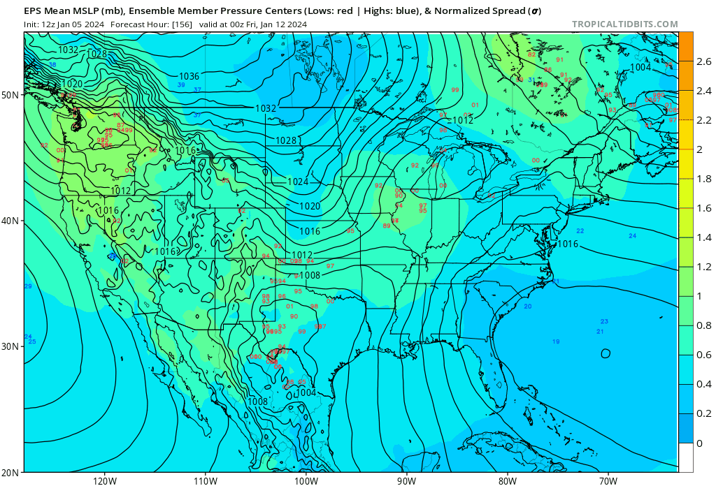
Many ensemble members agree on the very general idea for this system…relatively decent cutter followed by re-development closer to the New England coast. There are plenty of finer details not agreed on. Some members have a clipper ahead of this storm which would encourage a more suppressed solution. Members track the initial low from anywhere as far southeast as the Appalachians to as far northwest as Michigan before transferring to the coast from as far south as off VA/NC to as far north as New England. Most members have a 970s-980s mb low over New England or southeast Canada with the coastal, though members range anywhere from the 960s to 990s mb with the primary low farther west.
There’s a lot of uncertainty. Ingredients favor yet another large and deep cyclone with a warm and humid airmass still in front of it, arctic air behind it, and a potent shortwave to work with. The question will be if polar/arctic influence and the blocking can lead to a somewhat colder and farther southeast solution or not. Either way, yet another relatively impactful system appears likely across parts of the central and eastern CONUS.

Behind the January 12-13 storm the question becomes “where does the Arctic air go”? Some of this will depend on how the storm itself plays out…a more amplified/farther west solution may not pull the cold all the way to the East Coast behind it but a more robust coastal would pull more cold air towards the East Coast. Either way, the retrograding -NAO block will force the cold to role under it. A decent chunk of the cold air should get into all of the central and eastern U.S. in mid January…likely by January 13 in the central U.S. but probably not until January 15th or so for the East Coast.

There is a solid signal in the ensembles that another shortwave will try to eject out of the west around January 14th behind the storm discussed above. Most members appear rather suppressed due to cold air and high pressure behind the departing storm, though this could result in at least light snow potential farther south. Alternately, a few members appear to have a more amplified low into the Ohio Valley or Mid Atlantic with snow January 14-16, which could be possible if less cold gets pulled in behind the January 12-13 storm and gives the following shortwave room to amplify. It seems like one of these two systems will be the one pulls cold air all the way to the East Coast.
Moving into the Second Half of January & Early February:
We established above (and in my prior post in late December) how the pattern drivers are leading to and influencing the colder, more active pattern we are now finding ourselves in. How do the pattern drivers look beyond the middle of January?
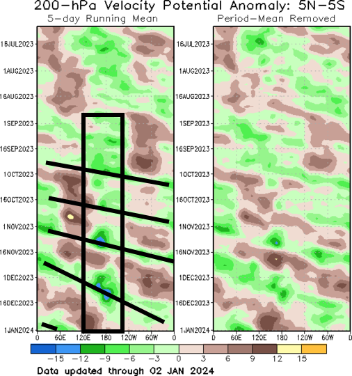
Let’s start with tropical forcing. There has been a coherent wave orbiting the tropics since the fall. Initially this seemed to be a higher-frequency Kelvin Wave, but the last couple of passes have been slower and more amplified like the MJO. As the strong positive Indian Ocean Dipole event collapsed we saw this more amplified MJO begin to develop. Each time this forcing has hit the vicinity of 150-180W (the central-eastern Pacific) it has amplified due to constructive interference with the El Nino. And each time it’s passed through the Pacific and western hemisphere since October a colder pattern has developed 1-2 weeks later. After passing through the Pacific and western hemisphere after December 15th we are on track for the forcing to reach the Dateline around or just after mid-January. This supports a more conducive pattern with a west coast ridge and high latitude blocking potentially returning during the last week of January or around the beginning of February at the latest.
The latest EPS depicts the general timing of the tropical forcing returning to the Pacific and then western hemisphere just after the middle of January:

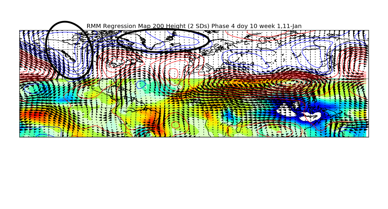
While this is intriguing for the end of January and early February over the eastern U.S. it is worth pointing out that tropical forcing will first move across the eastern Indian Ocean, Maritimes and western Pacific, favoring a West Coast trough/-PNA and even a +NAO around the 3rd week of January:
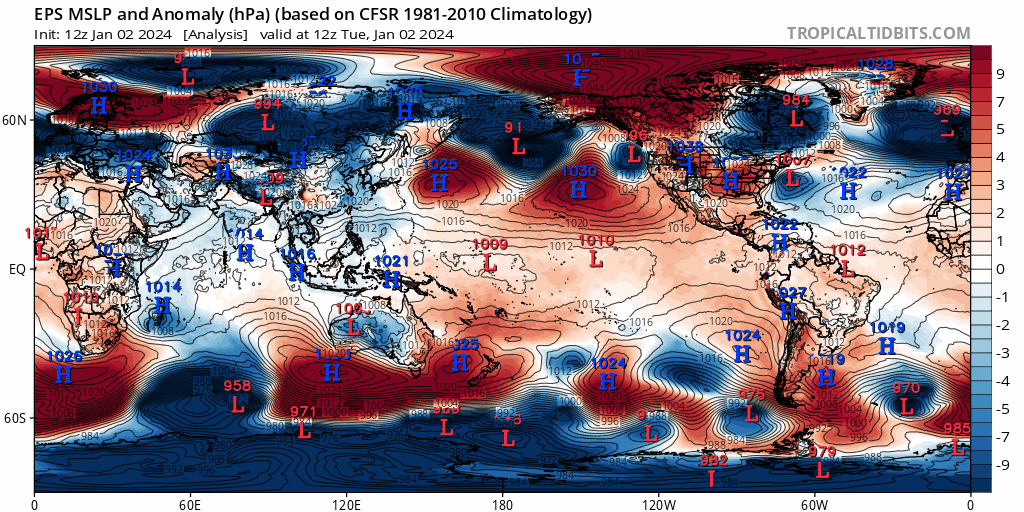
Let’s re-visit the mountain torque discussion from above through January 20th:

The EAMT is negative through about January 15th, supporting Pacific jet retraction and a -PNA. After that it begins trending more positively. You can see that low pressure appears to begin getting pushed towards the west coast of North America at the end of the loop due to the beginning of the jet extending. This may have a temporary effect of amplifying the West Coast trough in late January, but would eventually lead to a north Pacific pattern shakeup favoring a more positive PNA trend.
On the Rocky Mountain/Atlantic side, an initially -RMT also trends more positive late in the loop, which favors a stronger jet into the Atlantic and generally makes it harder to sustain blocking.
Keep these mountain torques in mind when viewing a 250mb wind mean EPS forecast loop valid the same timeframe as the above MSLP anomaly loop:

Note how the Pacific jet begins extending again around January 15th as the EAMT starts switching. The Atlantic jet also extends late in the loop. Tropical forcing working into the Pacific mid-late January is also helping extend the jet.

The last “driver” to mention is the stratosphere. A minor stratospheric warming event is ongoing and the mountain torque and tropical forcing do suggest more jabs at the stratospheric polar vortex in mid-late January. Most ensemble members have another minor warming in 2-3 weeks as a result with a healthy minority actually reaching major SSW criteria. The ongoing warming event is contributing to a significant high latitude blocking episode in early-mid January, and a subsequent warming could do the same around the end of January and early February.
Overall, it seems that the NAO block will decay after the middle of January and cold will gradually lift out of the eastern CONUS. A western U.S. trough will probably persist until the last week of January and there will be increased Pacific influence again during the second half of January. This will likely maintain an active pattern with west-east moving systems, though as the blocking decays and the cold air lifts out it may be hard to see a well-phased, highly amplified storm. There may be a narrow window of increased eastern CONUS snow potential the third week of January if the active pattern can coincide with lingering cold air. The CONUS will generally trend milder, though there will be some cold air lingering over Canada so some snow potential probably will continue across parts of the western U.S. and the northern tier farther east.
It seems the stars may align again for a solid period of blocking with a West Coast ridge, East Coast trough and an active sub-tropical jet from around the end of January through at least the first half of February. That would result in a persistently colder than normal and relatively snow pattern in the eastern CONUS for at least 2-3 weeks. The fail mode here is if the West Coast trough is too persistent and lasts into early February. While I think more blocking is likely regardless, which would inherently increase cold air into the CONUS and wintry potential, there’s some chance the western U.S. trough is difficult to kick out. To me that’s the most likely way the eastern U.S. gets skunked in the January 27-February 20 period. Otherwise, the factors seem pretty well-aligned for winter to return to the eastern half of the CONUS to end January and through the first half of February.
