
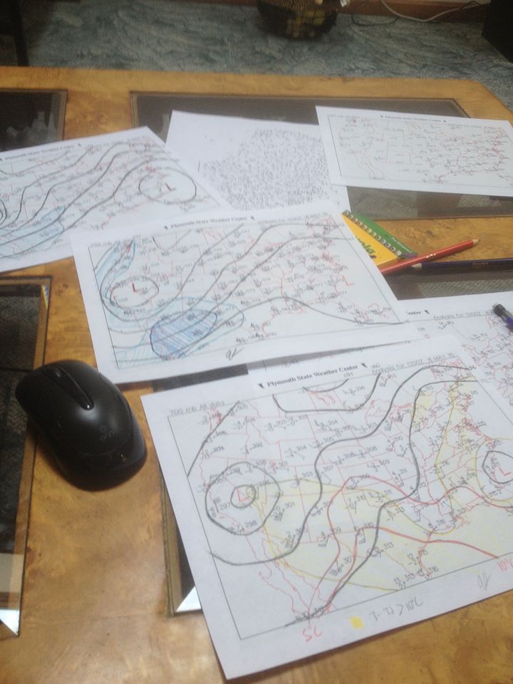
I woke up early to do hand analysis of the mandatory levels to take another look at today’s severe weather potential in the Plains.
Water vapor loops and 12z 250mb analysis show the nose of stronger winds aloft and a diffluent flow beginning to eject northeast into western TX. At the same time, surface analysis shows a remnant outflow boundary that at 12z extended from approximately AMA to just south of CDS and north of SPS and then northeast into OK along a line from roughly DUC to SNL to TUH. South of this outflow boundary, there appears to be rich boundary layer moisture per dew points in the mid 60’s in OK and near or above 70 in TX and per 12z soundings from FWD, SHV, DRT and CRP. North of this boundary, convective overturning Thursday afternoon/evening has stabilized the low levels at OUN.
12z soundings from AMA, DRT and MAF show very steep mid-level lapse rates associated with an elevated mixed layer, with some attempt at those lapse rates advecting east evident at FWD and OUN. The combination of steepening mid-level lapse rates in western and central OK and TX and deep moisture south of the remnant outflow boundary/especially south of the Red River and well east of the dry line has already led to moderate MLCAPE in the warm sector…especially in TX. Some diabatic heating south of the OFB in TX may lead to some increase in MLCAPE this afternoon where there is currently some sunshine.
12z analysis and current (14z) mesoanalysis reveals low to mid-level warm air advection occurring across western/central TX. Convection (likely elevated for now due to a good amount of MLCIN still present) has broken out along roughly the 9C isotherm at 700mb likely as this low to mid-level warm air advection causes some isentropic lift over the relatively shallow outflow boundary, which causes enough lift for parcels to reach their LFCs and develop thunderstorms.
As the speed max in the upper levels continues to eject into the southern Plains this afternoon, pressures will likely fall some as a weak lee cyclone attempts to develop. This should back surface winds some more and also increase the low to mid-level flow. Isentropic lift associated with the warm air advection should continue over the remnant OFB causing convection to continue along and just north of the OFB. There will be a battle between the low level southerly flow and new outflow from current storms, however I suspect the outflow boundary which is currently moving northward will inch north a little closer to the Red River in NW TX and SW OK…it may stay a county or two south of the river however depending on how the current convection plays out.
The current convection is in a zone of large scale ascent thanks to the thermally indirect circulation in the exit region of the ejecting speed max/jet streak and isentropic lift associated with low to mid-level warm air advection over the OFB. As the jet streak moves farther east this afternoon, the best large scale ascent and also low to mid-level warm air advection should shift east gradually, causing the convection to shift east with it. Favorable large scale ascent and Bulk Richardson Numbers on the order of 15-30 along the Red River ahead of this convection suggest it will probably grow upscale into an MCS this afternoon. The storms are currently elevated with just a hail threat, but some surface heating ahead of the storms along and south of the OFB combined with ongoing large scale ascent will likely try to weaken the cap enough for surface based storms to take over by 18z or so.
So, there appear to be two areas of better tornado risk today:
- Along the OFB ahead of the current storms, likely along/just south of the Red River.
- Behind the current storms over the TX Panhandle, potentially near the dry line/OFB intersection.
Both of these options were discussed last night, and there are pros and cons with each option. There is also a conditional severe weather risk farther south along the dry line in western TX this afternoon, however the better large scale ascent will be located north of this region which makes initiation more questionable.
As for the play ahead of the current storms:
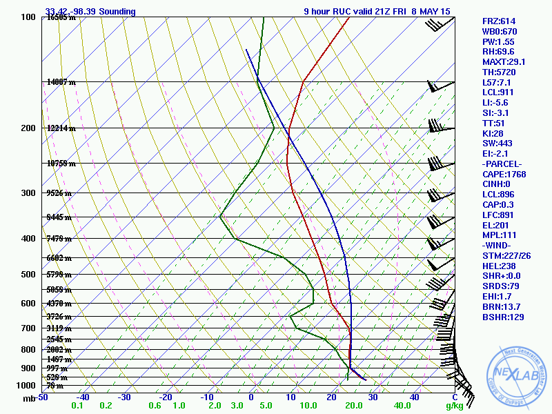
Forecast RAP soundings (12z run) from just south of the Red River for later this afternoon ahead of the ongoing convection (which it appears to handle surprisingly well) show favorable bulk shear for supercells with moderate MLCAPE. There is also strong low level turning, although the low level flow is on the weak side which keeps helicity values from getting too out of hand. There is some attempt at a cap, however it isn’t strong and the lift associated with the outflow boundary and large scale ascent should allow storms to fire/maintain themselves in the face of this weak cap.
This does suggest a tornado potential just south of the Red River this afternoon near the outflow boundary as storms move in…the HRRR is even more impressive with instability and to an extent the low level shear, but that may be overdone due to a good amount of cloud cover here only allowing for some diabatic heating ahead of the current storms. However, storm mode may ultimately hinder the tornado threat here. The storms are currently semi-discrete, however a relatively weak cap and large scale ascent do favor upscale growth into an MCS over the next few hours. The storms are currently moving ENE which may keep them a little north of the OFB, which could allow new storms to develop along the outflow boundary this afternoon…however I still have some doubts, as the storms growing upscale and becoming surface based later may allow a cold pool to develop that pulls the storms a little bit more to the right than what they’re moving right now.
As for the play later along the dry line in the TX Panhandle/western TX behind the current storms:
The ongoing storms should move safely east of the dry line by 20z and allow for recover along the dry line in western TX owing to steep mid-level lapse rates with the EML advecting east and some moisture advection thanks to a SSE flow…however, considerable uncertainties regarding outflow boundary location, cap strength and some subsidence behind the little upper level speed max moving over the region this morning exist which makes new storm initiation later less certain.
The 12z and 15z RAP both show the OFB plunging well south over western TX with little recover over the panhandle…I do not think this is realistic as the current storms are semi-discrete, elevated, and moving ENE away from the panhandle. Regardless, south of the OFB and near the dry line, the RAP does show sufficient CAPE and bulk shear for supercell development by this evening over west TX:
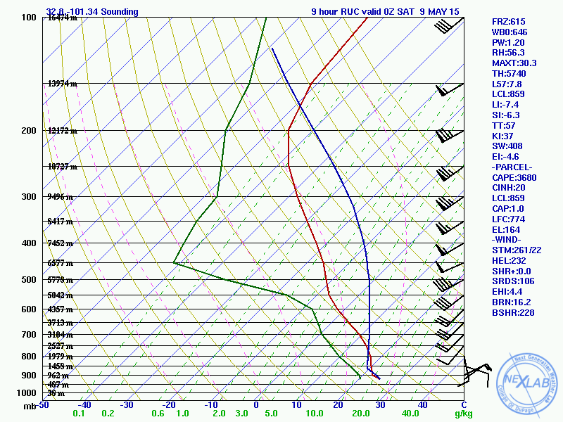
The rich tropical moisture doesn’t make it all the way back to the dry line on the RAP, and although there is strong low level turning the low level flow is weak…much weaker than farther east. Given the low to mid-level wind is partially a response to the thermally indirect circulation in the exit region of the modest speed max moving east across the region today into tonight, it makes sense that by this point the better low level flow will be farther east (closer to the expected MCS near or just south of the Red River).
So, while I do think the CAPE and bulk shear will support supercells across western TX and possibly the TX Panhandle with any new storms that develop late this afternoon or this evening…the weak low level flow and conditional nature of the threat due to a cap that will probably be stronger than the RAP shows and also due to some large scale subsidence behind the upper level speed max moving across western TX this morning…all makes the tornado prospects over western TX/the panhandle less appealing. If new storms fire there will be some tornado risk, especially with any storm that can interact with the remnant outflow boundary, but it’s more of a conditional threat.
If I had to re-draw my tornado threat map from last night, it would look something like this:
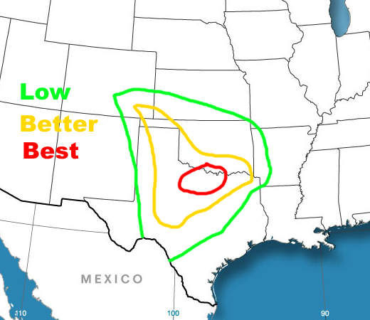
Although the storm mode will probably be messy by the time the ongoing convection reaches the “best” tornado risk area, favorable bulk shear and instability and locally enhanced low level shear along the outflow boundary will still support a few tornadoes in a relatively concentrated in my opinion. However, the messy storm mode may be enough to prevent stronger and longer tracked tornadoes. If some semi-discrete storms can occur south of the main MCS later this afternoon into this evening they may have a better chance at producing a higher end tornado.
The threat farther west along the dry line is more conditional. As last night, if I had to assign SPC style probabilities to the zones of tornadoes within 25 miles of a point, I’d go 2% green, 5% yellow, 10% red.
