

The Storm Prediction Center has placed all of Ohio in an “enhanced risk” (risk category 3/5) for severe thunderstorms for Thursday and Thursday night. The potential hazards include:
-Large hail
-Damaging winds
-Flash flooding, especially in central and southern Ohio
-A few tornadoes possible across the state
The best risk for severe thunderstorms will be between 1:00PM and 10:00PM across the state. The entire state has at least some risk for severe weather, however I suspect that southern and eastern Ohio stand the best shot at seeing severe weather.
Some meteorological details:

The big picture (second image) shows a strengthening low pressure system tracking into the western Great Lakes Thursday evening. This low pressure is expected to push a warm front through northern and eastern OH by Thursday afternoon, allowing the entire state to become warm and humid. The low pressure being strong will result in strong winds aloft and favorable turning of the winds aloft, which supports potential severe weather.

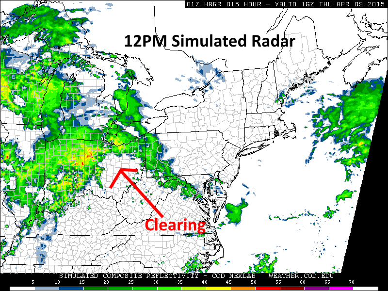
The potential fly in the ointment for severe weather will be ongoing showers/thunderstorms Thursday morning potentially limiting how much instability can develop across the state. One of our short term computer models (third image) shows rain and thunder across much of Ohio at 8AM, with some clearing by noon (4th image) across southern and eastern Ohio with more storms moving in from the west. There are multiple clusters of thunderstorms lining up to our west this evening so the idea of rounds of storms seems reasonable. The key to our severe weather threat will be if any clearing can occur between any more rain/storms and the activity expected to either develop or move in during the afternoon. A period of clearing would allow for sufficient instability to develop for severe weather, while no clearing or the afternoon storms moving in too quickly would keep the severe threat relatively minimal.
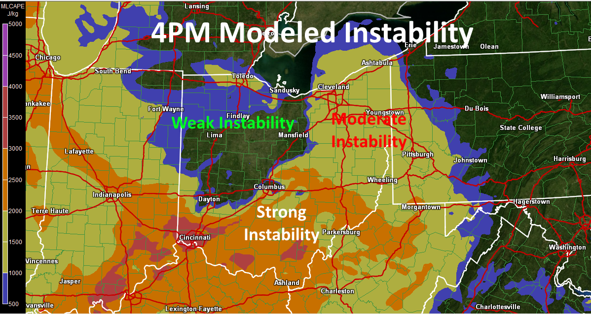
As alluded to above, I believe the best chance for enough instability to develop will be across eastern and especially southern Ohio…the morning rain/storms may largely miss southern Ohio, and there may be enough of a period of sunshine in eastern Ohio to develop instability. This is far from a certainty, but one of our models supports this idea (5th image).
If enough instability develops for strong to severe storms to develop, strong winds aloft and changing wind directions in the lower levels of the atmosphere support the potential for supercells with large hail and perhaps a few tornadoes. The supercell/tornado risk is somewhat dependent on getting scattered storms to develop (as opposed to a squall line), and how exactly the storms evolve is still uncertain…but the potential is there. One of our forecast products, the SREF significant tornado incredients, indicates a 45%+ probability of conditions being conducive for “significant” tornadoes across eastern Ohio at 5PM Thursday based on an ensemble of 20 models (6th image).

Again, this is highly contingent on enough instability developing and the storms being scattered and not coming in as a squall line, however some conditional risk for tornadoes certainly appears to exist. I’ll know much more Thursday morning.
