
The pattern may not be record cold with a KU threat every 4 days, but there’s some interesting potential over the next two weeks, with 4 things to keep an eye on after this weekend’s sloppy system.
Threat 1: Tuesday/Wednesday of next week
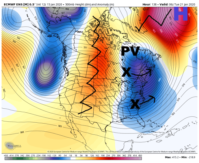
I ultimately don’t think this one amounts to much except for maybe the Carolinas/southeastern VA. A fairly potent sub-tropical jet shortwave slides off the Southeast Coast while a lobe of the PV gets displaced into southeastern Canada. I don’t think the two can phase and as is, the trough axis looks too far east for anything to come up the coast without a phase. But, it’s not horribly far off and if this was farther out I’d say to watch it closer. As is there have been some hints that the southern piece may bring some snow to the Southeast near the coast, and that the northern piece may bring snow showers or squalls to parts of the Northeast, even without any sort of phase.
Threat 2: Somewhere around the 24h-26th
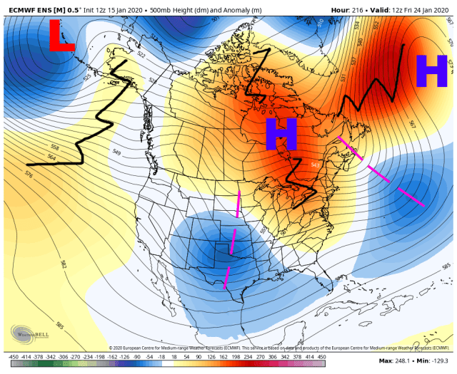
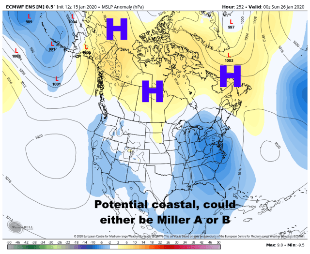

This one is fairly complex, but does have a low probability yet fairly high ceiling.
A robust sub-tropical jet shortwave will eject out of the southwest around the 23rd-24th, with what can be called bootleg (but persistent) blocking centered near Hudson Bay.
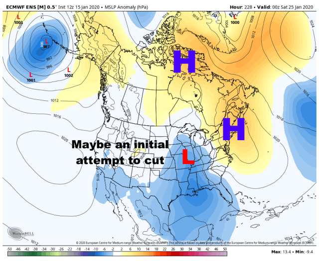
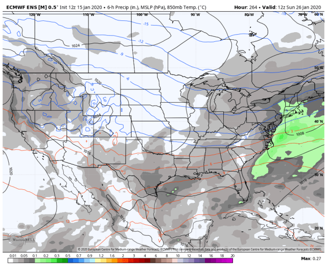
This is a robust piece of energy and some risk for an initial cutter does exist. With the blocking and surface ridging over the top, there would likely be an eventual transfer to the coast after any cutter. If there isn’t an initial cutter, the shortwave looks poised to go negatively tilted as it approaches the East Coast, which could favor a robust low developing offshore and moving up the coast. There would be some needle threading involved for the coastal plain, but the lack of a SE ridge with a trough sitting off the coast ahead of this shortwave and blocking over Hudson Bay does increase the odds of this occurring…again, if there isn’t a cutter. An initial cutter would warm our mid-levels quite a bit along the East Coast as the hour 240 QPF/850mb temp mean image shows…though, if there isn’t a cutter, or if there is a cutter but the Miller B takes over quickly enough, it is a plenty workable airmass.
How exactly this storm plays out will depend on the pattern in front of it over the Atlantic, the location/intensity of the Hudson Bay block, and what state the shortwave ejects into the Plains in. Anything from a strong cutter with little snow or just some front end snow in the east, to a cutter with useful Miller B development, to no cutter and a much higher risk of a coastal, to perhaps a southern slider across the Mid-Atlantic seem to be in play based on the pattern and individual ensemble members. Given how moisture-laden this system appears to be, if there is a coastal storm the potential exists for a significant snowfall somewhere. Given the cutter risk and somewhat marginal airmass, at first glance I think this narrowly favors the interior Northeast for snow over the coast, but this is by no means impossible to pull off along the coast either. If there is an initial low that comes out of the Plains and tracks towards the Ohio Valley or Great Lakes, some snow would certainly be possible in the Midwest and Great Lakes.
I am curious to see how quickly ridging may try amplifying over western Canada between the 24th and 26th…that has the look of something that may amp more than the ensemble mean suggests at this distance…if that occurred there could be more robust northern stream influence with this system which would increase snow potential.
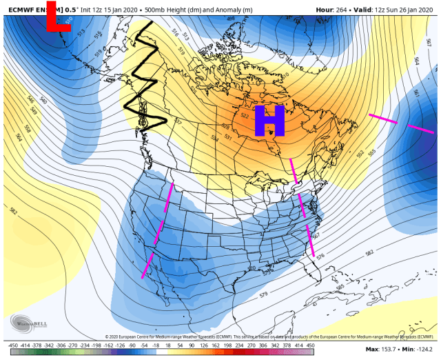
Threats 3 & 4: January 28 – February 1
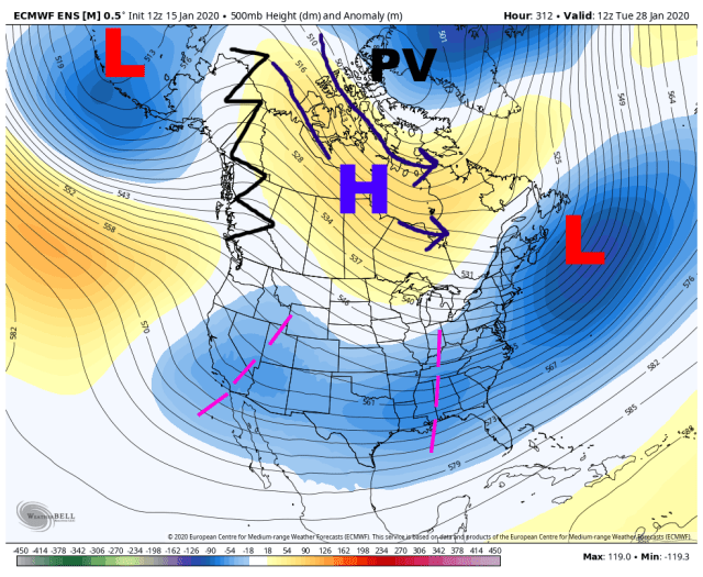
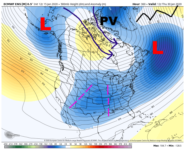

The ensembles suggest two more waves ejecting out of the southwest the last few days of January, with the polar vortex drifting towards the Davis Strait and allowing colder air to funnel into the central and eastern U.S. With wave after wave moving off the East Coast through this period and potentially developing into a robust storm, the ensemble mean has a persistent 50/50 low feature. With signs of more of a polar connection, a continued active sub-tropical jet, and a combination of an EPO cold press and 50/50 low ahead of any possible system keeping the baroclinic zone to the south, this period is very interesting for the East Coast. However, it is way too early to determine which waves may amp, cut, be suppressed, etc, and it will take quite a while to sort out these wave spacing issues.
The EPO and NAO will be worth watching over the next week or two…I definitely can see a brief EPO tank during week 2, as there will likely be cyclonic wave breaks over the northern Pacific starting in about a week. The NAO may dip if any of these storms deepens enough to get a cyclonic wave break over the NW Atlantic, though right now only a small number of ensemble members do that at some point. Either occurring would make things more interesting and I do think we see the EPO try to go more negative than the ensemble means suggest right now during week 2.
Overall, the sub-tropical jet will give us plenty of opportunities over the coming weeks for snow across parts of the Midwest, Great Lakes, Ohio Valley, Northeast, Mid-Atlantic, and maybe even Southeast. With still some uncertainty in the pattern and wave spacing issues that will take a lot of time to work out, along with some marginality to the amount of cold especially initially, it’s way too early to guess which wave may develop into a storm and produce snow as there’s a wide envelope of possible solution with every wave ejecting out starting around January 25th. But, there’s definitely potential.
