
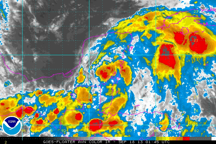
Looks like the tropics will remain relatively active close to home for the next few days. Satellite shows a well-defined low pressure system just north of the Mexico/Belize coastline this evening with some thunderstorms firing near this low pressure. This system is tracking towards the WNW and should move into the Bay of Campeche on Wednesday.
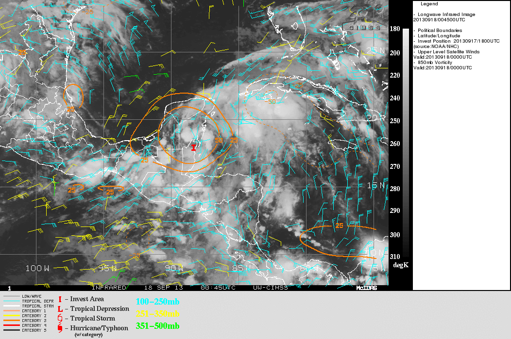
Environmental conditions are currently marginally conducive for development. An upper level low just west of the low pressure may cause modest northerly shear over the system for the next day or two…however that upper level low is shown by all modeling to weaken/move west. A weak upper level anti-cyclone (high pressure) exists near the low pressure and this is helping to vent the thunderstorms associated with the low pressure…note the winds to the northeast of the low pressure rushing away. Our forecast models show this kind of upper level wind pattern continuing, if not improving over the next few days.
The above image shows winds fanning away in the upper levels over the low pressure…at this point in the Bay of Campeche. In addition, note how the vorticity, or low level spin (organge lines on second image) is consolidated with this low pressure system. Unlike with hurricane Ingrid, there is not going to be a tropical cyclone on the other side of Mexico in the Pacific to compete with this low pressure system. This promotes an organizing system. Although waters are a bit cooler in the Bay of Campeche than they were before Ingrid…they are still marginally favorable for tropical cyclone development. If this low pressure can get out of the southern Bay of Campeche…waters are warmer and are warm to a great enough depth to promote an intensifying tropical cyclone.
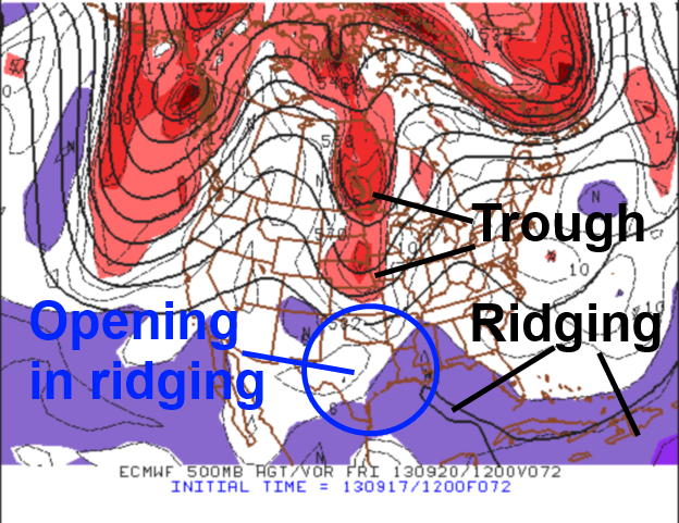
So the question is…where will this low pressure system go? While there is currently a mid-level ridge of high pressure over much of the Gulf of Mexico that will limit how far north this low pressure system can track over the next couple of days…this ridge is expected to be eroded over the next 2-4 days by a trough dropping into the central US (above image). If this low pressure system is still weak in 3-4 days it will likely move into Mexico before this hole in the ridging allows the system to possibly turn north. If this low pressure system deepens into a decent tropical storm or hurricane within the next 3-4 days this trough should be able to pick up this low pressure system and threaten the northern Gulf Coast.
Which option is more likely? It’s tough to tell as most of our forecast models are rather split. What is often noted as the most accurate model, the ECM, actually picks up half of this system with the trough and slings it towards Florida in about 5-6 days and leaves about half of the system back over the southwestern Gulf of Mexico.

An experimental suite of ensemble guidance for tropical cyclone track…that has shown promise the last two seasons…shows this uncertainty. Most of these models actually show the low pressure system getting stuck in the Gulf of Mexico in 5-6 days. I think this is unlikely but illustraits how this track forecast has much uncertainty…although a system getting stuck in the Gulf of Mexico seems unlikely to me. Given the favorable environment that seems to await this low pressure system in the Gulf of Mexico and the fact that a stronger cyclone would be more likely to be picked up by the trough moving across the central US late this week…I have a sneaky feeling that this system won’t go quietly into Mexico. Either way…stay tuned…

