
GFS and Canadian shift east slightly; Euro holds firm:
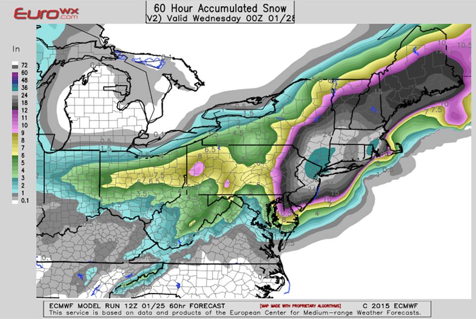
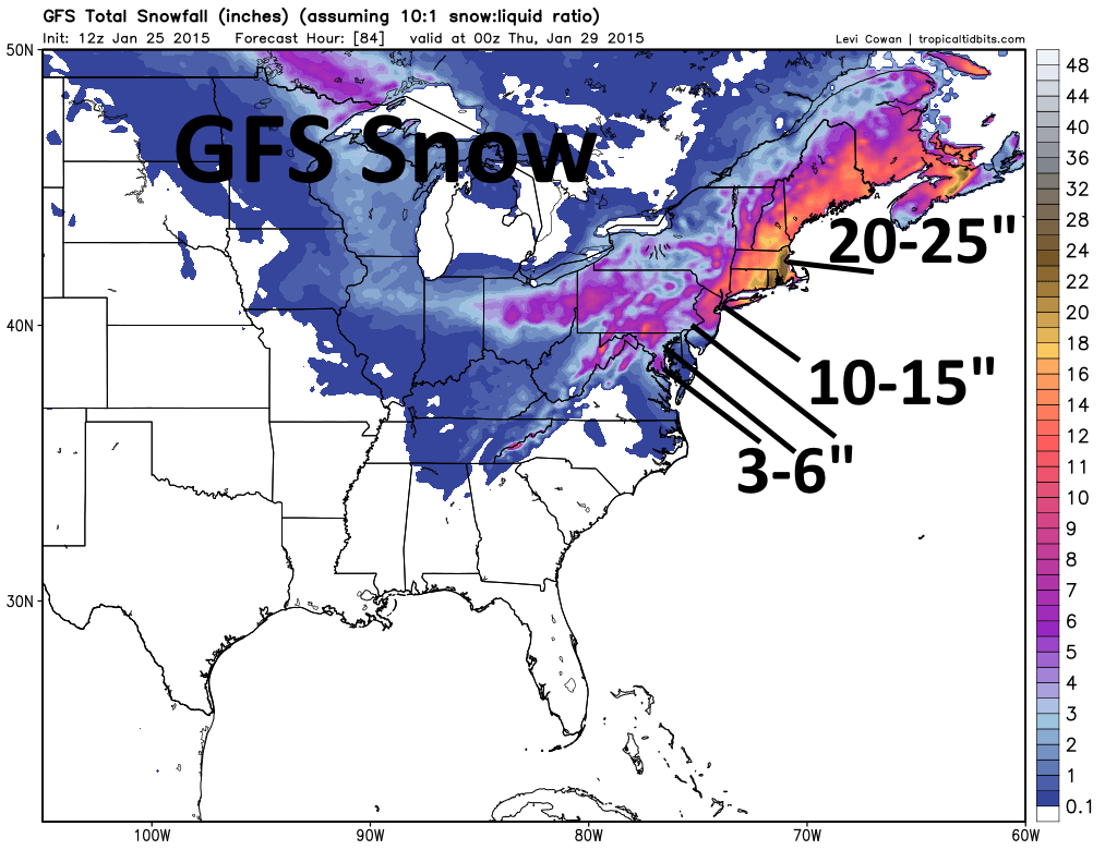
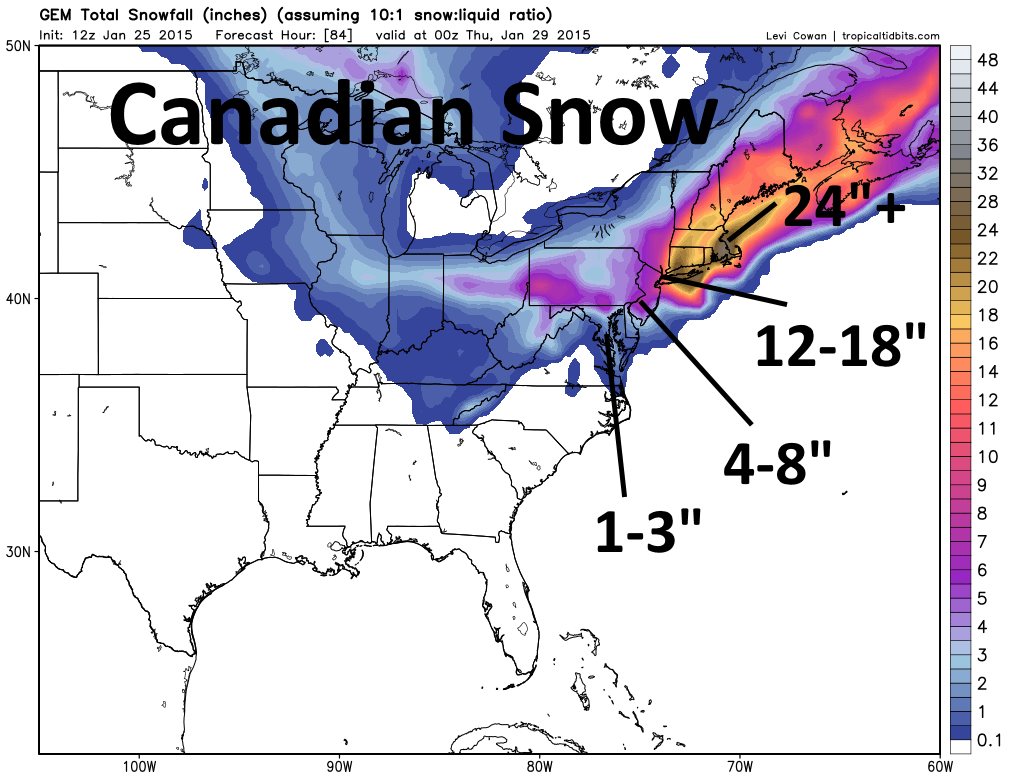
Good afternoon. We are seeing conflicting signals among our three main computer models for the upcoming East Coast snowstorm Monday through Tuesday. The GFS and Canadian have shifted the storm –and heaviest snow– east, with Boston still getting crushed on both models and NYC getting a little less. Philly would see only light to moderate snow per the GFS and Canadian. The European model has held course and strongly supports our forecast from yesterday of the heaviest snows extending from northern New Jersey to Boston, with locations as far south and west as eastern Pennsylvania, Philly and the Delmarva getting in on heavy snows.
When diving a little deeper, the GFS and Canadian appear to be a little “flatter” with the clipper system that will move off the East Coast on Monday and re-develop into a strong Nor’ Easter. This causes the low pressure to strengthen a little farther east, pulling the snow a bit east with it. The Euro has been almost exactly the same with this energy for 3 straight runs now and develops Nor’ Easter farther west. The Euro’s consistency, and support from its ensembles, is hard to ignore.
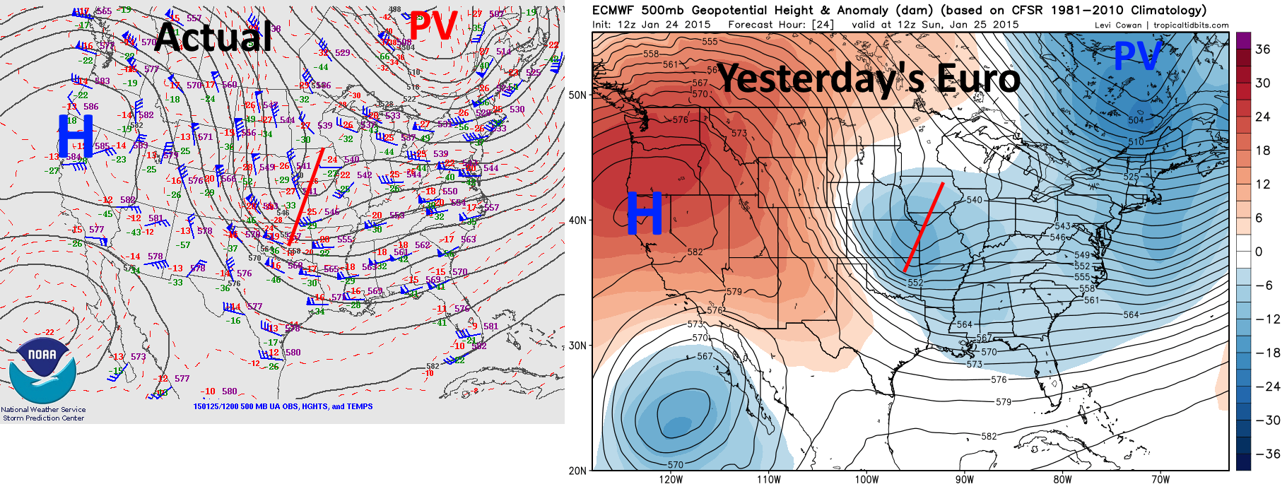
When looking a little deeper, the Euro’s projection for where our clipper would be this morning on its run yesterday afternoon was extremely close to reality. The clipper (over the Midwest, labeled with a line) is almost EXACTLY as strong as the Euro expected and where the Euro expected…the polar vortex over SE Canada (labeled PV) is almost EXACTLY as strong as the Euro expected…and the strong ridging over the western US is essentially EXACTLY as strong as and in the same spot as where the Euro expected.
Considering that nothing appears to have changed from yesterday and the Euro is holding steady with its farther west solution, I am not inclined to change my forecast…which includes 1-3″ for DC, 3-6″ for Baltimore, 12-18″ for Philly, and 18-30″ for NYC and Boston with blizzard conditions in the latter two. Coastal flooding is also a concern along the coastline due to strong on-shore winds. The only minor change may be to diminish amounts over the Delmarva a little bit. For the full meteorology behind the forecast, please see the blog entry from last night.
Euro images normally can’t be posted to social media due to copyright issues…however, the Euro snow map I posted is from another very popular page, and was already freely out there because of that.
