
Definitely think there’s some interesting potential for a low CAPE/high shear severe weather event from portions of Ohio and West Virginia points east across Virginia, Pennsylvania, New York, Maryland, Delaware, New Jersey and perhaps parts of New England late Wednesday afternoon straight through to very early Thursday. Although the previous SPC D3 outlook basically punted another day, I suspect they’ll start introducing severe probs for a fairly large area, and depending on how things evolve I could see a decent slight risk area (potentially even an enhanced) being needed for some of the areas outlined above.
There will be two primary areas to monitor for potential severe weather:
1) Main cold front moving east across parts of eastern OH/WV/upstate NY/PA/MD into New England, NJ and DE late Wednesday afternoon through early Thursday morning.
2) A secondary cold front across Ohio/WV and perhaps adjacent northern KY/western PA late Wednesday afternoon into Wednesday night.
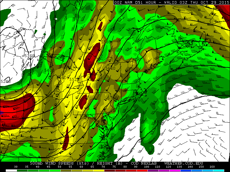

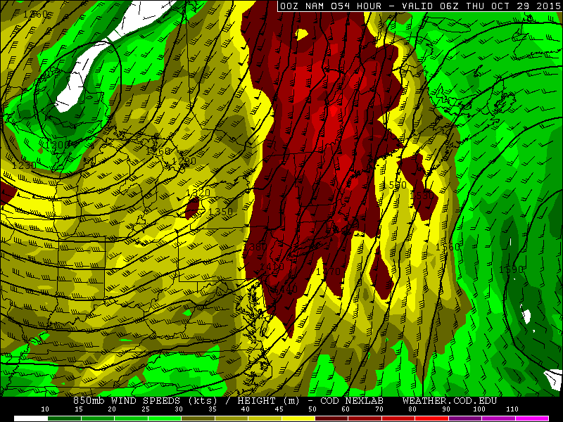
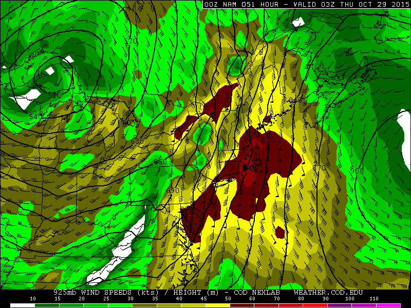
Very strong 500mb winds are expected to overspread the warm sector Wednesday afternoon into Wednesday night, with surface to 500mb shear near or above 50 knots over quite a large area. Very strong low level winds and associated high low level shear values are expected along and ahead of the main cold front Wednesday and Wednesday night…with 850mb winds of 50-70 knots over quite a large area and 925mb winds of 40-50 knots even.


With a potent vort max and strong height falls overspreading the warm sector Wednesday evening and night…and strong lift with the surface cold front…even though CAPE will be meager (on the order of a couple to few hundred J/KG of MLCAPE) I’d have to imagine that low topped convection will develop along and ahead of the cold front by Wednesday evening and rapidly progress east. The shear values look very supportive of any line segments easily producing strong to at times damaging winds, and there appears to be enough low level turning and helicity for the possibility of a spin up tornado or two.
The NAM and GFS both develop a little instability along a trailing secondary type cold front across OH later on Wednesday into Wednesday night, and the NAM really ramps up shear in this area Wednesday evening too, so some locally strong to damaging winds wouldn’t surprise me if any convective showers can develop along this feature farther west Wednesday afternoon into Wednesday night…although the strongest forcing and strongest low level shear (and overall better threat) appear to be farther east along and ahead of the primary cold front.
