

The Storm Prediction Center has placed essentially all of Ohio in at least a “marginal risk” (risk level 1/5) for severe thunderstorms Sunday afternoon and evening, with a “slight risk” (risk level 2/5) for southern Ohio. There will be the potential for multiple rounds of rain and storms across Ohio between Sunday morning and late Sunday evening as a low pressure goes by and pushes a couple of fronts through.
Sunday Morning:

The front that has stalled across southern Ohio today will lift back north Sunday morning and likely make it to Lake Erie by around noon. This front may focus a few showers/perhaps a rumble Sunday morning as it lifts north. I don’t expect widespread storms with the warm front, and temperatures and dew points will jump up south of the front. After the front and chance for a few showers/storms lifts north, there’s a potential window of dry weather into the early afternoon.
Sunday Afternoon:

A belt of stronger winds throughout the atmosphere will arrive mid to late Sunday afternoon, which will add a source of lift over Ohio and likely cause more storms to develop. The best chance of storm development will likely be after 2:00PM (though something isolated could go a bit sooner), and with a cold front moving in from the west by early evening, warm front lingering over Lake Erie near the southern shoreline, and perhaps a “pre-frontal trough” ahead of the cold front (note the wind shift from southwest to south-southeast over eastern Ohio) there could be multiple areas of scattered to numerous thunderstorm develop by early Sunday evening. The best shot for widespread storms will likely be near where the cold front and warm front are close together, which may be over northwestern Ohio or Lake Erie. With that said, the entire state will be at risk for at least scattered storms developing or moving in at some point between mid Sunday afternoon and Sunday evening.
Sunday Night:
The cold front will sweep through Ohio Sunday evening into the overnight. Storm coverage and intensity should begin to diminish after 10:00PM Sunday evening as we lose instability thanks to the sun going down and also see the low and some of the better large scale “lift” in the atmosphere begin to pull away. Regardless, a risk for storms will persist in eastern Ohio until the front moves through around midnight or so Sunday night.
Severe Threat:
Some ingredients will be in place for stronger storms on Sunday. Here is a basic checklist of what we’re looking at from an ingredients perspective:
- Instability: Moderate instability is expected, which is enough for severe storms if other factors are favorable
- Directional shear (change in wind direction with height): Moderate near the warm front, marginal elsewhere. This may allow for some rotation in storms, particularly near the warm front…but, the risk for rotating storms and tornadoes would be higher if there was more directional shear.
- Speed shear (change in wind speed with height): Moderate, particularly late afternoon and early evening. This may favor longer lasting storms that organize into small clusters or lines with an accompanying severe risk.
- Lifting mechanisms: Present, with fronts in the area, perhaps a “pre-frontal trough” or wind shift, and some large scale lift due to a favorable jet stream orientation over our area.
Adding all of that together, here’s my assessment of the overall severe threat Sunday afternoon and evening for Ohio:

The sufficient instability and speed shear suggest that storms organizing into small clusters or lines will be possible, which would drive a damaging wind gust risk with some storms. Some directional shear suggests that a few storms may develop into supercells for a time, which would increase the hail risk and perhaps bring the risk for a tornado or two into the picture. We are missing stronger directional shear though, so the tornado threat while higher than zero should not be out of control. Some areas may see multiple rounds of storms which could result in local flash flooding.
All in all, Sunday will likely be a “run of the mill” type severe weather day with several severe storms across the state, but nothing that we’ll be talking about years later. I do suspect that more of Ohio will be placed under the “slight risk” by the Storm Prediction Center. Keep an eye to the sky during the afternoon, and have indoor backup plans in place in case storms rumble towards your area.
Memorial Day Looking Nice:
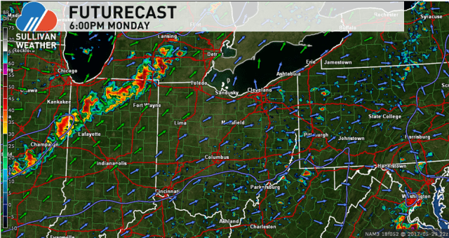
Monday should be dry for much of Ohio with highs in the 70s. A very isolated shower isn’t impossible in southern and eastern Ohio Monday afternoon, but I wouldn’t cancel any outdoor plans over it. The better chance for rain comes later Monday evening as another cold front comes in from the northwest; storms with the front should be weakening as they move in later Monday evening, but a number of areas will likely see some rain Monday evening into Monday night with the next cold front.
