
I think it’s safe to say “here we go” for Sunday – Tuesday in the Midwest and Northeast!
The pattern features a west-based -NAO, 50/50 low, large shortwave, confluence ahead of it over New England and SE Canada, and ridging out west:

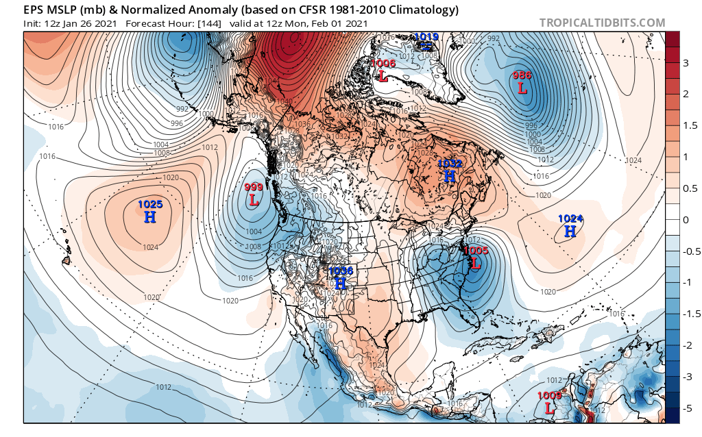
In addition, this storm will occur while the NAO is transitioning, the PNA is spiking, and the AO is persistently, deeply negative:

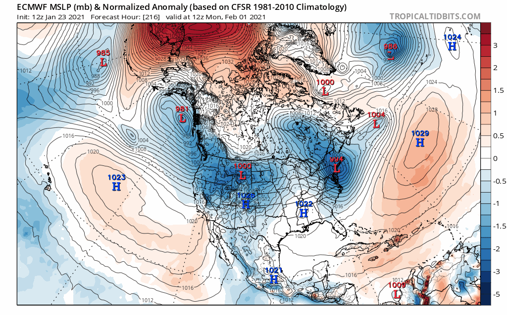
This all leads to a robust low pressure tracking across the Ohio Valley and then re-developing off the Mid Atlantic coast, with a strong high pressure over southeast Canada:

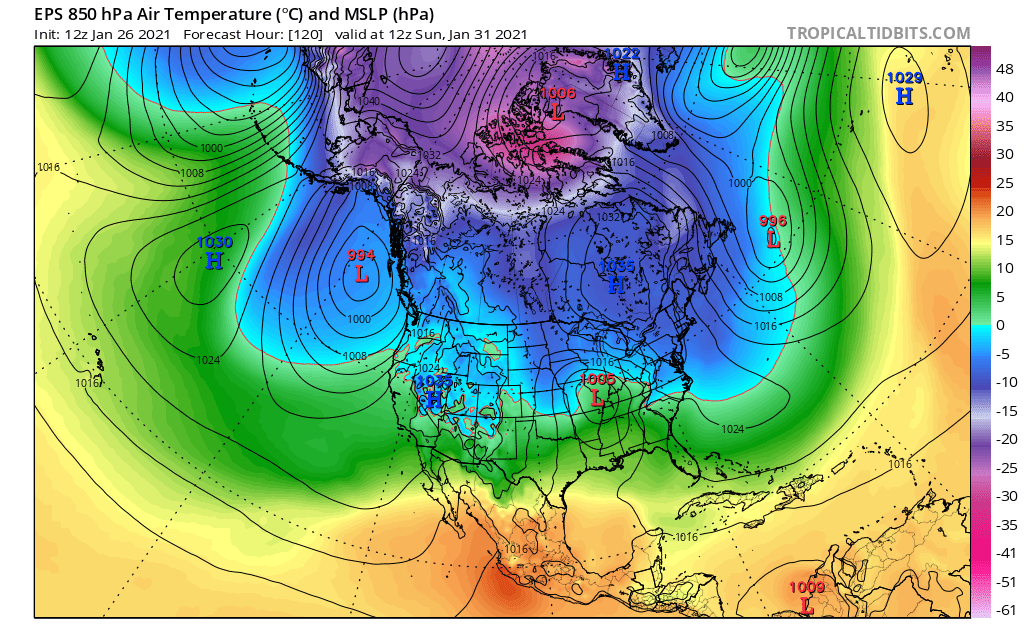
The TPV that gets shoved through the Northeast Friday – Saturday (and probably bringing snow squalls, gusty wind, and the coldest airmass of the winter so far) will ensure that there is an actual cold airmass in place in front of the storm, with reasonable cold behind it as well:

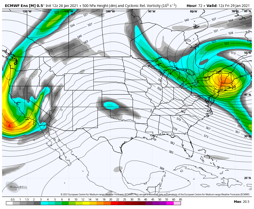
At first blush, there appear to be some similarities to what was modeled for this Thursday and will end up really suppressed on the East Coast. Here is this Thursday’s set-up:

Note how there’s little wave spacing in front of the storm, with a PV also depressing heights over the Great Lakes, and little ridging behind the storm. This resulted in a solution that was a bit too far south and too late of a bloomer for a more notable East Coast storm. Compare to what’s modeled with the Sunday – Tuesday system:

More wave spacing both in front of and behind our storm, a more amped shortwave itself, and more room to breath over the Great Lakes. This storm should be more amped across the board.
The trends at 500mb over the last few days on the EPS have been for more blocking, a more optimally placed 50/50, a more amped shortwave, and more ridging and wave spacing to the west. All generally argue for a more amped storm, but also force the track farther south especially over the Midwest:

Surface trends match, along with a much better high over southeast Canada:
After these trends, that are still ongoing, the EPS mean 500mb evolution is classic for a slow-moving, sprawling winter storm from the Midwest to the East Coast:
Most of the 12z GFS, Canadian, and Euro ensemble members have a notable swath of snow somewhere across the Midwest or East Coast. Location and amounts vary considerably, especially on the East Coast (note that some snow in the Great Lakes, New England, and southern Mid Atl / SE are from prior events, but any larger swaths are from this storm):


We definitely have a storm to track for a lot of areas! In the Midwest, I feel that eventually the strength of the wave should limit southern shifts, though a couple more are possible if the western ridging or blocking trend any stronger. On the East Coast, I feel this is more likely to trend more amped than extremely suppressed. However, quality cold in front of the storm and good blocking should increase the odds of overrunning snow in front of the storm anyways, even into the Mid Atlantic, and should eventually limit how far north this can trend.
It’s too early to lock in snow in a given spot, but a bunch of areas are in the game for this one.
