
The pattern coming up is going to feature plenty of cold / Arctic air over North America to tap, along with a continued tendency for blocking over the Atlantic.
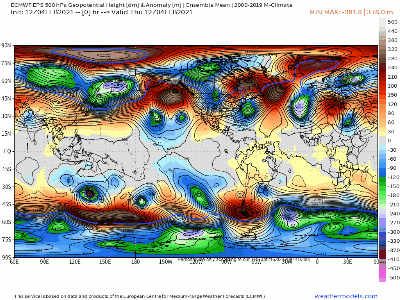
A Rossby wave making machine will be in place over the western Pacific, encouraging persistent north Pacific blocking and a cross polar flow into Canada. This is occurring while a tendency for high latitude blocking continues across the board for multiple reasons.

This loop of the GFS helps show the continued cross polar flow into Canada, and how the retrograding -NAO helps shove the tropospheric polar vortex towards the CONUS this weekend and next week, bringing a cold snap to much of the Lower 48. With the Pacific blocking likely continuing for the forseeable future, the model shows Arctic air reloading towards the end of the run in mid-late February.
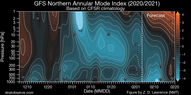
One of the reasons we will remain “blocky” for the forseeable future is the continued downwelling of the weakened stratospheric polar vortex into the troposphere, which encourages a -AO and blocking:
On top of that, there’s been a recent uptick in tropical forcing across the western hemisphere, and western Pacific forcing will continue until further notice:

This deposits momentum in the tropics and subtropics (enhances the sub-tropical jet). Because momentum is a conserved quantity, the increase in momentum in the tropics and subtropics results in a decrease in momentum in the higher-latitudes, which causes a tendency for blocking. The 12z GFS is shown as an example of this, note how the stronger sub-tropical jets over the eastern Pacific and eastern Atlantic occur beneath weaker higher-latitude flow, and how this encourages high latitude blocking:

The persistent western Pacific forcing will keep our Pacific blocking in place for most of February, and the Arctic air dropping into North America will encourage continued cyclogenesis near the east coast, which will help encourage Atlantic blocking as well.
Basically, the US will lean cold for much of February. There will be a baroclinic zone across the southern / eastern US, though the cold will seep south and east at times given the -NAO and the quality of the cold that will be available. The Arctic air may lead to near to below average precipitation for a lot of the CONUS (save for perhaps the southeast/east coast), but the pattern will stay at least somewhat active given the baroclinic zone and hints of a subtropical jet. The GEFS and EPS weekly forecasts for the next 30 days speak for themselves:
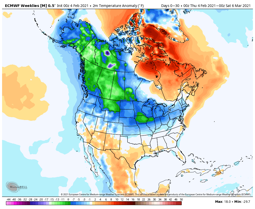

While suppression and lack of moisture may be a problem at times, we are already in a rather wintry stretch that will probably last through all of February, and perhaps into early March.
