

Some nice nocturnal storms at present as a shortwave glances the edge of an EML advecting into the northeast.
There’s higher end potential with Wednesday’s action, though uncertainty still exists.
It seems like there are two mechanisms to watch for thunderstorm development and severe weather:
- Remnant MCS or MCV from tonight’s activity over the Great Lakes over PA/NJ during the morning and into the afternoon
- The southward advancing cold front during the afternoon and evening
A shortwave tracking from the Great Lakes towards northern New England will cause modest 500mb PVA and height falls during the afternoon hours, along with some right-entrance support in the upper-levels. This, along with the front, provides “okay” forcing in central/northern PA and NJ, though forcing is weaker the farther south you go.
What happens with number one is uncertain, and will affect number two…
Let’s discuss the environment briefly:
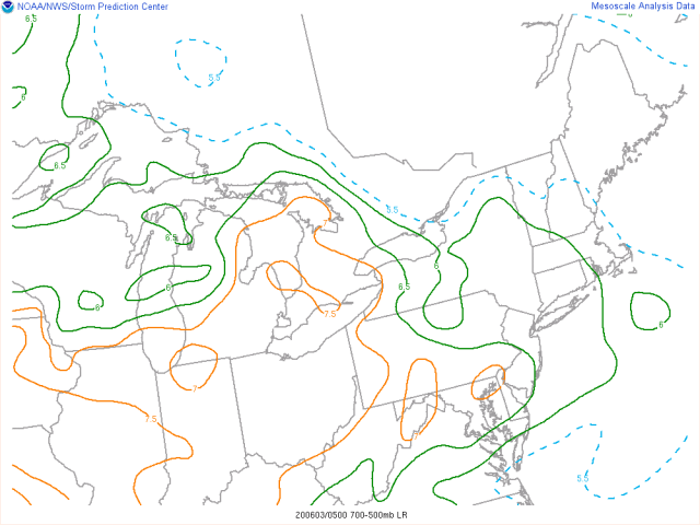
We have an unusually untapped EML for the Northeast advecting in tonight into Wednesday…as dew points increase into the low-mid 60s on Wednesday, moderate MLCAPE somewhere on the order of 1500-2500 J/KG will develop by early-mid afternoon where sufficient heating occurs. The NAM dew points seem overdone. The mid-upper level speed max glancing the region will contribute to moderate to strong deep-layer shear of 30-50 knots (increasing to the north) across the northern mid-Atlantic. Some mid-level dry air will contribute to over 1000 J/KG of DCAPE in the warm sector, with mixing to near or above 850mb where heating occurs yielding decent low-level lapse rates and inverted-V soundings.
These ingredients will support large hail and microbursts with any cellular activity, along with swaths of any damaging wind with any lines or clusters, with locally significant wind damage with any bows.
Let’s try to take a stab at the convective evolution now:
The MCS over the Midwest/Great Lakes as of this writing is the big wild card. It’s running a bit faster than guidance, but is gradually becoming less organized and isn’t diving south of guidance yet. There are a few ways this MCS can go into Wednesday:
- It runs slightly faster than guidance and moves into eastern PA late-morning and into NJ by the noon hour. It holds together and brings showers/storms, with perhaps some severe threat developing by the time it gets into NJ…likely not a high-end solution though. If this occurs, it likely nudges the frontal convection south, from parts of central/northern IN/OH into central/southern PA, perhaps northern MD, DE, and southern NJ. This would to an extent limit the threat compared to what the environment suggests is possible.
- It doesn’t run faster than guidance and weakens considerably by morning. However, it leaves an MCV and likely contributes to differential heating, which encourages new storm development by late-morning across central or northern PA that tracks into NJ early-mid afternoon. Given the environment, MCV-aided fresh development a little later in the day could yield significant severe in eastern PA or NJ…with frontal convection from central and northern IN/OH into southern PA, MD, and DE.
- It does whatever the 18z NAM did and completely dissipates in the morning, with unabated heating along the front into northern PA and NJ, with frontal convection firing along I-80 early to mid-afternoon.
Option 1 seems most likely, though option 2 isn’t off the table if the MCS falls apart/slows down some by morning…option 2 has a fair amount of model support, but since it’s running on the fast side of guidance now I’d slightly favor option 1. Option 3, aka the 18z NAM, will likely not happen.
The frontal convection from the Ohio Valley into the Mason-Dixon area will be in an environment of weaker forcing and more moderate, mostly uni-directional shear but with strong instability beneath the EML. The weaker forcing may somewhat temper the coverage of severe weather, but splitting cells with a large hail / microburst threat are initially favored given the moderate but uni-directional shear. Despite the weak forcing, the sloppy storm mode and flow parallel to the front does argue for fairly quick upscale growth into small lines and clusters…any lines or clusters that bow could produce corridors of severe wind given the high DCAPE, low-level inverted-V and sufficient shear. Where exactly the northeastern extent of the frontal convection is over eastern PA/NJ will depend on how the MCS plays out.
The tornado threat generally isn’t much across the board, but if we see the MCV play out the right way over eastern PA/NJ (ie, later timing so it destabilizes in front of it), there could be a non-zero QLCS-style tornado risk. Otherwise, I’d be rather surprised if there was a tornado with the cold frontal convection.
I can see two areas where the SPC considers enhanced risk probabilities or higher…one is E PA into NJ IF the leftover MCS/MCV is slow enough. This could warrant 30 or 45% wind probabilities along with “hatching”, but, is highly conditional and I’m not sure we get it out of the gate at 6z. The other is perhaps eastern OH or western PA into southern PA and perhaps northern MD or DE if there’s high enough confidence in scattered strong convection along the cold front here. Despite weaker forcing and somewhat less shear, the thermodynamics are very favorable for this region, and scattered strong convection would yield enough severe coverage to justify a 30% wind risk in that region. Given a fairly messy storm mode it’s hard to expect more than a 15% hail risk being justified, but if there are any more persistent discrete supercells they could produce locally significant hail given the moderate to strong CAPE and steep mid-level lapse rates.
Fingers crossed that when I roll over and peak at the radar at 8 AM that the MCS isn’t already messing everything up!
